Search
Now showing items 11-20 of 40
MEASURING GEOSPATIALLY EXPLICIT PERCEPTIONS OF SUDANESE ETHNIC GROUP LOCATIONS : A COMPARISON OF SUBJECT-MATTER-EXPERTS AND ONLINE DATA
(East Carolina University, 2013)
The geospatial perceptions of Sudan and South Sudan subject-matter-experts (SMEs) regarding the location of Sudanese ethnic groups were collected and analyzed, in order to determine how to synthesize and gain meaning from ...
Perceptions of Hurricane Risk Among North Carolina's Coastal Residents : A Case Study of Hurricane Irene
(East Carolina University, 2013)
The perception of risk to natural hazards is a very complex topic and there are multiple factors that influence it. However, two factors have generally been overlooked. Through the use of mail-out surveys of residents in ...
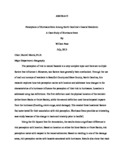
Mid-Summer Dry Spell and Agriculture in Jamaica : Implications for farming practices, techniques and culture
(East Carolina University, 2011)
At the beginning of the 21st century, Jamaica stands in a precarious situation which could have serious implications for the island's future. This stress may not have derived from a decrease in precipitation due to climate ...
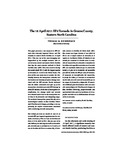
The 16 April 2011 EF3 Tornado in Greene County, Eastern North Carolina
(2012)
This paper presents a case study of an EF3 tornado that adversely impacted Greene and Pitt Counties in eastern North Carolina on 16 April 2011. This was one of the most damaging and longest-lived of the multiple tornados ...
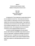
Debris Flow Fan Evolution, Chalk Creek Natural Debris Flow Laboratory, Colorado
(East Carolina University, 2012)
Terrestrial laser scanning (TLS) is a surveying technique used to gather dense point cloud data that can be converted to high-resolution digital elevation models (DEM). TLS techniques are employed in the current study to ...
Spatial Modeling of the Risk of Mosquito-borne Disease Transmission, Chesapeake, Virginia
(East Carolina University, 2010)
The increase in mosquito populations following extreme weather events poses a major threat to humans because of mosquitoes' ability to carry disease-causing pathogens. In areas with reservoirs of disease, mosquito abundance ...
EVALUATING HURRICANE ADVISORIES USING EYE-TRACKING AND BIOMETRIC DATA
(East Carolina University, 2011)
The cartography of hurricane advisories is challenged with communicating complex information regarding hazards and spatio-temporal uncertainty. This research presents an exploratory geovisualization study assessing how ...
Sweetpotatoes in a Globalizing World : The Effects of Globalization on North Carolina's Sweetpotato Industry
(East Carolina University, 2012)
This study examines the form and effects of globalization on North Carolina's sweetpotato industry. A commodity chain analysis was conducted by constructing North Carolina's sweetpotato commodity chain (SPCC) through the ...
The Utility of Digital Globe's WorldView-2 Satellite Data in Mapping Seagrass in North Carolina Estuaries
(East Carolina University, 2011)
Submerged aquatic vegetation (SAV) is a valuable natural resource in North Carolina estuaries. The State's Coastal Habitat Protection Plan (CHPP) has stated a need to monitor SAV coverage over time. Thus, the Albemarle-Pamlico ...
Evaluating the Sustainability of Heritage Tourism and Historic Preservation in New Bern, North Carolina
(East Carolina University, 2010)
After nearly a half century of suburbanization, economic development specialists and urban planners have begun to appreciate the unique aesthetic and heritage landscapes of underutilized downtown areas as potential geographic ...